The first, facilitating issuance of regulations on village supported by local government policies for rural development of low emissions; second, installation of information boards that are durable about threats, potency, the extent and amount of carbon content on a variety of land use of micro; third, cultivation of Jarak (jatropa curcas) to produced a source of energy (biofuel) and selling it when it surplus production; fourth, cultivation of Jelutung Rawa (dyera lowii) on the buffer zone of national parks as an alternative source of family income for the long term (that can be produced up to 60 years); and fifth , the cultivation of mangroves (avicinea, sp) in coastal areas to prevent abrasion and sea water ingress into agricultural land as well as long-term alternative sources of income because the mangrove forest can be foundcrabs, shrimp, fish and so the other could be sold or used alone. All of them are permanent and very important initiative to reduce emissions and control deforestation and forest degradation.
Increased capacity of communities supported by the local government for rural development plans sustainable low emissions energy sources by strengthening and increasing community income to do following trainings, for example; training of human resource management; training of marketing management; training of financial management; training of count carbon; training of participation mapping; training of jatropa curcas cultivation to become a source energy (biofuel); training of dyera lowii and avicinea, sp cultivation as sources of additional revenue was an attempt early action to reduce emissions, control of deforestation and forestdegradation.
Making books and films for teaching materials to low-emission rural development, creation offline media publications (like; posters, stickers, t-shirts, etc.) and the publication online media (like; website and interactive webGIS) then the next on the publication in local media (like; tv and newspapers ) is a to promote conservation of naural forests to maintai. the carbon storage capacity.
Very little villages development planning using low emission villages development planning. The importance of low emission villages development planning should be an integrated unit in landuse who emphasized the importance of controlling deforestation. Indirectly, this planning a manifestation of the long-term carbon mitigation.
Our from the Foundation Gita Buana trying to influence the dependent variable using the independent variables through the mediating variable. Influence the outcome from the dependent variable is to continue for the long term (more of the 20 years).
Facilitating of micro land use planning and build a sustainable low emissions villages planning is the independent variable that can influence the REDD as the dependent variable, but variable independent are not automatically affect varibable dependent, there is need for mediating variables, that is variable the strengthening of energy and variable income community. Variable model of the basic activities that we would do for more details can be viewed below;


Variable model of the basic activities
Description:
X1 and X2 = Independent Variables;


M1 and M2 = Variable Mediation;
Y = Dependent Variable
Independent Variables = Facilitating of micro land use and planning
Dependent Variable = REDD
Variable Mediation = Strengthening of energy and improvement of living standards
Independent variables and mediating variables on the form from indicators that have been determined. To more easily see the variable indicator framework can be seen in this in the model can be seen below;

Description:
Y = REDD
X1-1 = Socializing understanding of the village development sustainable low emission
X1-2 = Analyst time series satellite images
X1-3 = Survey and identification of the use of shared public space
X1-4 = Preparation of land use of micro
X1-5 = Villages development planning and integrated low emission energy and the strengthening of community income
X2-1 = villages policy
X2-2 = Local government policy
X2-3 = Installation of information boards ang durable
X1-4= Workshop
X2-2 = Local government policy
X2-3 = Installation of information boards ang durable
X1-4= Workshop
M1-2= Training of human resources management
M1-3= Marketing management training
M1-4= Financial management training
M1-3= Marketing management training
M1-4= Financial management training
M1-5= Training calculate the carbon
M1-6= Training jatropa curcas cultivation of and manufacture of bio fuel energy
M1-7= Training dyera lowii and avecine, sp cultivation of and mangroves as sources of additional revenue
M2-1= Nurseries
M2-2= maintenance
M2-3= Producing biofuel energy
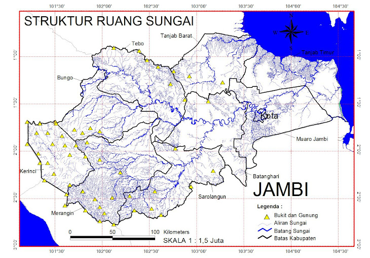
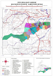
These activities are located in 4 villages: Air Hitam Laut village, Sungai Cemara village, Labuhan Pering village and Sungai Benuh village. District Tanjung Jabung Timur Province of Jambi Indonesia.
Because lack of initiative for rural development planning low-emission and the lack of micro spatial unit in the coastal villages of the East Coast Jambi cause increased emissions of the more powerful the impact of natural disasters and floods in the form of abrasion. Quick or later will be affect the damage Berbak National Park because of the villages in the coastal areasare the villages that buffer the national park. On the other hand, agricultural production has decreased from salt water into farmland. Deforestation that will be made public to support its economy. Because they are unable to farm.
M1-6= Training jatropa curcas cultivation of and manufacture of bio fuel energy
M1-7= Training dyera lowii and avecine, sp cultivation of and mangroves as sources of additional revenue
M2-1= Nurseries
M2-2= maintenance
M2-3= Producing biofuel energy
These activities are located in 4 villages: Air Hitam Laut village, Sungai Cemara village, Labuhan Pering village and Sungai Benuh village. District Tanjung Jabung Timur Province of Jambi Indonesia.
Because lack of initiative for rural development planning low-emission and the lack of micro spatial unit in the coastal villages of the East Coast Jambi cause increased emissions of the more powerful the impact of natural disasters and floods in the form of abrasion. Quick or later will be affect the damage Berbak National Park because of the villages in the coastal areasare the villages that buffer the national park. On the other hand, agricultural production has decreased from salt water into farmland. Deforestation that will be made public to support its economy. Because they are unable to farm.


Tidak ada komentar:
Posting Komentar