Rabu, 21 Juli 2010

NASA membuat peta kedalaman hutan dunia yang pertama

The work - based on data collected by NASA's ICESat, Terra, and Aqua satellites -- should help scientists build an inventory of how much carbon the world’s forests store and how fast that carbon cycles through ecosystems and back into the atmosphere. Michael Lefsky of the Colorado State University described his results in the journal Geophysical Research Letters.

new global tree canopy height map A first-of-its-kind global map shows forest canopy height in shades of green from 0 to 70 meters (230 feet). For any patch of forest, the height shown means that 90 percent or more of the trees in the patch are that tall or taller. Areas without forest are shown in tan. Credit: NASA Earth Observatory/Image by Jesse Allen and Robert Simmon/Based on data from Michael Lefsky.

The new map shows the world’s tallest forests clustered in the Pacific Northwest of North America and portions of Southeast Asia, while shorter forests are found in broad swaths across northern Canada and Eurasia. The map depicts average height over 5 square kilometers (1.9 square miles) regions), not the maximum heights that any one tree or small patch of trees might attain.

Temperate conifer forests -- which are extremely moist and contain massive trees such as Douglas fir, western hemlock, redwoods, and sequoias--have the tallest canopies, soaring easily above 40 meters (131 feet). In contrast, boreal forests dominated by spruce, fir, pine, and larch had canopies typically less than 20 meters (66 feet). Relatively undisturbed areas in tropical rain forests were about 25 meters (82 feet), roughly the same height as the oak, beeches, and birches of temperate broadleaf forests common in Europe and much of the United States.

subset of new global tree canopy height map showing continental United States A forest canopy height map of the contiguous United States. Credit: NASA Earth Observatory/Image by Jesse Allen and Robert Simmon/Based on data from Michael Lefsky.

Where’s the Carbon?

Scientific interest in the new map goes far beyond curiosities about tree height. The map has implications for an ongoing effort to estimate the amount of carbon tied up in Earth’s forests and for explaining what sops up 2 billion tons of “missing” carbon each year.

Humans release about 7 billion tons of carbon annually, mostly in the form of carbon dioxide. Of that, 3 billion tons end up in the atmosphere and 2 billion tons in the ocean. It’s unclear where the last two billion tons of carbon go, though scientists suspect forests capture and store much of it as biomass through photosynthesis.

 
a beech tree
  European Beech.
Credit: Forestryimages.org/University of West Hungary/Norbert Frank› Larger image
 
artist concept of ICESat
 An artist’s representation of ICESat in orbit.  
bristlecone pines
Stand of bristlecone pine on Almahgre Mountain in Colorado.  
Credit: Forestryimages.org/USDA Forest Service/Dave Powell› Larger image  

There are hints that young forests absorb more carbon than older ones, as do wetter ones, and that large amounts of carbon end up in certain types of soil. But ecologists have only begun to pin down the details as they try to figure out whether the planet can continue to soak up so much of our annual carbon emissions and whether it will continue to do so as climate changes.

“What we really want is a map of above-ground biomass, and the height map helps get us there,” said Richard Houghton, an expert in terrestrial ecosystem science and the deputy director of the Woods Hole Research Center.

One of Lefsky’s colleagues, Sassan Saatchi of NASA’s Jet Propulsion Laboratory, has already started combining the height data with forest inventories to create biomass maps for tropical forests. Complete global inventories of biomass, when they exist, can improve climate models and guide policymakers on how to minimize the human impact on climate with carbon offsets.

More immediately, said University of Maryland remote sensing expert Ralph Dubayah, tree canopy heights can be plugged into models that predict the spread and behavior of fires, as well as ecological models that help biologists understand the suitability of species to specific forests.

NASA Home
Page Last Updated: July 21, 2010
Page Editor: Melissa Quijada
NASA Official: Brian Dunbar

Musim Badai 2010 : Peta Badai Tropis di Chanthu (Lau Cina Selatan)

AIRS infrared imagery of Chanthu from July 19 at 18:05 UTC showed strong convection (purple) from northeast to southwest
 
NASA's AIRS instrument infrared imagery of Chanthu from July 19 at 18:05 UTC showed strong convection (purple) from northeast to southwest. Credit: NASA/JPL, Ed Olsen 


AIRS saw an area of very high thunderstorm (purple) cloud tops from northeast to southwest around the center of TD4W.
NASA's Aqua satellite's AIRS instrument infrared image on July 18 at 0723 UTC saw an area of very high thunderstorm (purple) cloud tops from northeast to southwest around the center of TD4W.
Credit: NASA/JPL, Ed Olsen 

Indonesia memiliki potensi pendapatan dari REDD sebesar US$3,8 miliar hingga US$15 miliar per tahun. Namun,

Oleh: Yeni H. Simanjuntak 

SANUR, Bali (Bisnis.com): Potensi pendapatan yang hilang akibat dari kewajiban untuk konservasi hutan, di sektor usaha hulu hingga ke hilir, harus ikut dihitung dalam mekanisme penurunan emisi dari deforestrasi (reducing emissions from deforestation/REDD).

Sejumlah ilmuwan yang mempresentasikan penelitian mereka dalam salah satu sesi di acara pertemuan internasional Association for Tropical Biology and Conservation (ATBC), yang diselenggarakan mulai Selasa hingga Jumat pekan ini, menyebutkan hingga kini potensi pendapatan tersebut belum dimasukkan dalam harga karbon yang dijual lewat mekanisme REDD.

REDD merupakan salah satu mekanisme yang digunakan dalam transaksi emisi karbon, di mana pemilik hutan bisa mendapatkan sejumlah dana dari karbon yang tersimpan di hutan tersebut, sehingga hutan tersebut tidak dapat dimanfaatkan untuk kebutuhan komersial.

Jaboury Ghazoul, profesor di bidang ecosystem management dari Swiss Federal Institute of Technology Zurich, menyebutkan Indonesia memiliki potensi pendapatan dari REDD sebesar US$3,8 miliar hingga US$15 miliar per tahun. Namun, ada sejumlah biaya yang timbul dari komitmen untuk memelihara hutan tersebut.

Menurut dia, REDD menimbulkan biaya administrasi atau institusional karena untuk bisa mendapatkan dana REDD dibutuhkan usaha yang cukup besar, biaya pengawasan, hingga kerugian yang timbul akibat tindak korupsi terhadap dana yang diperoleh.

Biaya lainnya adalah biaya yang timbul dari masalah sosial dan biaya ekonomi berupa potensi pendapatan yang bisa dihasilkan dari berbagai sektor usaha dan kehidupan yang sebelumnya tergantung pada pengelolaan hasil hutan, termasuk sektor yang ikut terkena dampak apabila usaha-usaha yang memanfaatkan hasil hutan dikurangi aktivitasnya.

Mengutip data dari Kementerian Kehutanan dan sejumlah institusi lainnya, Ghazoul menyebutkan setidaknya ada 350.000 orang yang bekerja langsung di sektor kehutanan, di mana 36% di antaranya merupakan penduduk asli yang berada di berbagai kawasan di Kalimantan.

Selain itu, ada 3,1 juta orang pekerja yang terkait dengan hutan, seperti pekerja pada industri bubur kertas (pulp) yang memang dihasilkan dari kayu. Ghazoul juga mencontohkan nasib para pekerja yang terkait dengan industri furniture di Jepara, yang pastinya akan berubah apabila pasokan kayu untuk industri tempat mereka bekerja dikurangi atau bahkan dihentikan. Setidaknya ada 176.470 pekerja furniture di Jepara.

“Usaha pengangkutan hingga jasa yang terkait dengan keberadaan industri furniture di sana pasti akan ikut terpengaruh. Ini baru satu daerah kecil saja di Indonesia. Ada banyak daerah-daerah lain yang juga pastinya akan mengalami nasib yang sama. Jadi, semua ini harus diperhitungkan di dalam REDD,” kata Ghazoul hari ini.

Dia menyebutkan salah satu alternatif yang dapat dilakukan Pemerintah Indonesia adalah menggunakan dana yang diperoleh dari mekanisme REDD untuk menciptakan hutan yang kayunya dapat digunakan untuk industri yang selana ini tergantung pada hutan yang ada.

“Ini memang membutuhkan usaha yang keras. Atau dana dari REDD bisa juga digunakan untuk membuka peluang usaha baru, sehingga masyarakat bisa beralih ke sana. Namun, itu lebih sulit lagi untuk dilakukan,” jelasnya.

Dia mengakui belum melakukan penghitungan secara spesifik apakah dana yang diperoleh Indonesia dari REDD mencukupi untuk membuat program-program pengganti tersebut. “Saya belum melakukan kalkulasi apakah dana dari REDD cukup untuk mendanai semua itu,” katanya saat ditemui seusai presentasi.

Namun, Brendan P. Fisher, dari Princeton University, menyebutkan sejumlah riset menunjukkan dana yang diperoleh dari REDD tidak cukup besar untuk mengganti semua potensi ekonomi yang hilang. “Tidak cukup besar untuk meng-off set semua itu.”

Herry Purnomo, peneliti dari Center for International Forestry Research (Cifor), mengatakan Indonesia sudah pernah menghitung besaran dana REDD yang setimpal dengan kerugian ekonomi yang timbul akibat mekanisme REDD. “Namun, kurang komprehensif. Opportunity cost untuk masa depannya tidak ikut dihitung.” (mrp) 


Sumber : http://web.bisnis.com/keuangan/ekonomi-makro/1id194726.html 

Clark Labs Publishes New Focus Paper on Modeling REDD Baselines using IDRISI's Land Change Modeler


Clark Labs has recently published a Focus Paper on modeling REDD baselines with the Land Change Modeler application in their IDRISI GIS and Image Processing software. Reducing Emissions from Deforestation and Forest Degradation (REDD) is a climate change mitigation strategy for the protection and maintenance of forests that has gained momentum with conservation organizations, project developers and governments in developing countries. As forests play a major role in the sequestration of carbon, especially tropical forests, REDD offers great potential for reducing greenhouse gas emissions. Carbon offset payments, based on an assigned financial value for the likely carbon storage capacity of protected or maintained forests, provide incentives for adopting such a strategy.
A REDD project is comprised of a number of significant components and requires the expertise and input of multiple parties. This paper discusses one of the required elements, the modeling of a baseline, a scenario of the likely greenhouse gas emissions if the project were not to be implemented. The modeling relies on land cover and land use change maps as its foundation. Baseline mapping includes determining historical deforestation rates and patterns, identifying the unique drivers and underlying factors of the area’s deforestation, and modeling potential scenarios.
The new Focus Paper provides a general overview, featuring a case study of a REDD project developed by the government of Madagascar, with assistance from Conservation International and the BioCarbon Fund, for the area along the Ankeniheny-Mantadia Corridor. The overall objectives for this REDD project were to reduce greenhouse gas emissions, increase protected areas, and reduce the loss of biodiversity by reconnecting forest fragments and reducing future forest fragmentation.

Wednesday, March 17, 2010

Modeling Deforestation in the Bolivian Lowlands Species and Carbon Impacts - Carbon Impact

Carbon Impact
Projecting future land cover scenarios is critical also for assessing the impact on carbon mass. The traditional method has been to use a uniform carbon figure across a region (Figure 8). In our case, we have a uniform carbon figure for all forested areas per hectare and we can simply calculate the loss of carbon mass due to projected deforestation. However, using a proxy of forest land cover, we can refine this process by redistributing the gross carbon mass associated with all forested areas based on the forest’s NDVI (Figure 9) so that the intensity of the NDVI will be our spatial proxy, i.e., the higher the NDVI, the more carbon. Using the projected land cover map to 2015, we identified only the deforested areas and redistributed the gross carbon mass using the NDVI (Figure 10). Assuming business as usual, the table shows the potential additional loss of carbon mass using a non-uniform carbon mass surface (Figure 11). Using modeling tools such as GIS, we can present various scenarios with differing potential impacts for designing carbon offset projects while simultaneously managing biodiversity.


Wednesday, March 10, 2010

Modeling Deforestation in the Bolivian Lowlands Species and Carbon Impacts - Model Development

Model Development
Change modeling in LCM is empirically based (the empirical method chosen for this study is the multi-layer perceptron neural network), using areas of known transition from land cover maps along with user-specified explanatory variable maps that express the state of driving forces or the inherent suitability of land to undergo a specific transition. In this illustration, a total of 26 variables were used (Figure 1). The result is a transition potential map for each modeled land cover transition -- an expression of the readiness of land to undergo a transition in the next time step. These transition potential maps then serve as primary inputs to the prediction process, along with predicted quantities of change derived by Markov Chain Analysis. The specific allocation of change is then achieved by means of a multi-objective land competition process with intermediate recalculation of dynamic variables (such as proximity to disturbance) and associated transition potential maps.

In our case, forest change was modeled based on land cover maps from 1992 to 2001 (Figure 2). To assess the quality of the model, a prediction was made to 2004 for comparison with a known validation map. The resulting model attained a Pierce Skill Score of .61. Two types of maps were produced: a hard prediction map that expresses one change scenario (Figure 3) and a soft prediction map (Figure 4) which provides a comprehensive assessment of change potential, i.e., a map of vulnerability to change for the selected set of transitions. The soft prediction result therefore shows the potential that any given area may change at some future date and is very important for identifying areas of high risk: an important planning concern.


Once the model was calibrated, additional future scenarios were then produced. One such scenario was a prediction of the Bolivian Lowlands to the year 2015 (Figure 3) and the assessment of this scenario on endemic species habitat. Using collections of species range polygons, initially supplied by NatureServe and subsequently recalibrated using LCM, a species richness map was developed for all birds, mammals, and amphibians. The Bolivian Lowlands is home to 73 endemic species, 36 amphibians, 16 mammals, and 21 birds. This map was combined with the 2015 soft prediction map to derive a risk of biodiversity loss (Figure 5). We then applied the same process to all the endemic vertebrate species to derive a risk of endemic loss (Figure 6).

Assuming business as usual, the potential loss could be devastating to biodiversity in Bolivia. For the period we do know, from 2001 to 2004, 4% of current mammal habitat was lost (Figure 7). Tools such as these provide an important means to assist those engaged in important conservation practices and to prioritize threatened environments.


Friday, March 5, 2010

Modeling Deforestation in the Bolivian Lowlands Species and Carbon Impacts - Introduction

Introduction
With the importance of tropical forests for climate system function and biodiversity, land cover change in the Amazon has been the focus of intensive research. In Bolivia, the rate of deforestation is second only to that of Brazil. Due in part to a tremendous amount of economic growth in recent decades, the Bolivian Lowlands have seen forest loss of almost 3 million hectares between the years of 1992 and 2004, with two-thirds of this loss coming between 2001 and 2004 alone. With forests dominating over 50% of the land cover in lowland Bolivia, special planning tools are essential to manage, monitor and prioritize the risks associated with economic development and to assist the conservation community better understand the changes and impacts that are taking place. This poster demonstrates a set of techniques to assess land cover change, predict future scenarios, and assess the potential impacts of these scenarios on biodiversity and carbon loss. These techniques will be demonstrated using the tool Land Change Modeler (LCM) as found in the IDRISI GIS and Image Processing system.

Tuesday, February 23, 2010

Comparison of Two GIS-based Land Change Modules for Constructing REDD Baselines in Bolivia

AAG - 2010 Annual Meeting, Washington, DC

Comparison of Two GIS-based Land Change Modules for Constructing REDD Baselines in Bolivia

is part of the Paper Session:
Land Use and Spatial Analysis

scheduled on Sunday, 4/18/10 at 8:00 AM.

Author(s):
Oh Seok Kim* - Department of Geography, University of Southern California

Abstract:
With the increasing concerns in developing methodologies for Reducing Emissions from Deforestation and Degradation (REDD) projects, there is a need to understand the characteristics of existing Land-Use/Cover Change (LUCC) modules. This research presents a comparison of two existing approaches: GEOMOD Modeling (GM) and Land Change Modeler (LCM). The comparison uses data from a case study in Chiquitanía, Bolivia. Data from 1986 and 1994 are used to simulate land-cover of 2000; the resulting maps are compared to an observed land-cover map of 2000. GM and LCM simulate baseline deforestation at the pixel-level. The model structures of linear extrapolation and Markov chain are compared to review quantity of LUCC; and the model structures of empirical frequency, logistic regression and multilayer perceptron are compared to review allocation of LUCC. Relative operating characteristics, figure of merit and multiple resolution analysis are employed to assess predictive accuracy of multiple transition modeling. By design, GM lacks the potential to model multiple transitions, while LCM may produce different results for each simulation. Based on the model structure and predictive accuracy comparisons, the LCM's logistic regression seems the most suitable LUCC module to construct a REDD baseline in this case. However, it is crucial to emphasize that these results are strictly limited to this particular case. Thus, there is no obvious method that is most accurate, so if a REDD project employs predictive GIS-based LUCC modeling for its spatially-explicit baseline construction, it should include the framework employed in this research to establish the baseline in a scientific manner.

Thursday, February 18, 2010

Workshop at the AAG Annual Meeting

Modeling REDD-Baselines Using IDRISI's Land Change Modeler
Tuesday, April 13, 1:00pm – 4:00pm
Instructors:
Stefano Crema, Clark Labs, Clark University
Florencia Sangermano, Clark Labs, Clark University
Marc Steininger, Conservation International
Workshop Capacity: 30
Room: Lincoln Room 3
The implementation of REDD projects requires a best estimate of the deforestation and/or degradation baseline. The baseline is derived from the spatial modeling of the expected future trends of deforestation using maps of historical deforestation and biomass estimates.
Land Change Modeler (LCM) is a robust modeling tool that allows calibration, validation and the creation of maps of expected future deforestation trends. Clark Labs, in conjunction with Conservation International, has designed a REDD tool within LCM which guides the user through the steps of baseline development and directly produce tables and graphics necessary in the reporting process.
This workshop will cover the complexity of REDD baseline creation using real case studies to illustrate the process.

Tuesday, February 2, 2010

LCM on Google's Earth Engine interface.

Clark Labs Receives Support from Google.org to Develop an On-line Prototype of its Land Change Modeler Application to be run on Google’s Earth Engine

Worcester, MA -- Google has contracted Clark Labs to develop an on-line prototype of the Land Change Modeler application to run on Google’s Earth Engine interface. This development complements the on-line forest monitoring applications of Carnegie Institution for Science (CLASlite) and IMAZON (SAD), demonstrated on Earth Engine at the COP 15 meeting in Copenhagen last month.

The on-line prototype will contain much of the functionality of the land change modeling component of Clark Labs’ Land Change Modeler application, included within the IDRISI GIS and Image Processing software, as well as within its extension to ArcGIS. The system will allow users to analyze, model and predict deforestation and then to evaluate the amount of carbon involved.

The hope is that this on-line system will help support the implementation and evaluation of REDD (Reducing Emissions from Deforestation and Degradation) projects. The intent of REDD is to assign financial value to the carbon stored in forests such that sequestration of that carbon becomes a viable alternative to other uses such as conversion to pasture and farmland. The Land Change Modeler provides a critical ingredient for REDD projects in that it can be used to establish the business-as-usual (BAU) baseline that projects the future deforestation in the absence of a REDD project. Quantification of this projected deforestation and comparison with various governance scenarios provides the basis for evaluation of the carbon stocks involved and potential compensation.

It is hoped that the REDD program will lead to a significant reduction in CO2 emissions, enhance ecosystem services and biodiversity conservation, and provide opportunities for poverty reduction.

Implementing REDD projects will depend on modeling which requires significant data and computing resources. Google’s new Earth Engine platform will ameliorate the financial burden of implementing REDD projects.

“The objective of Earth Engine is to enable organizations such as Clark Labs to run their algorithms on-line, powered by Google’s computational capacity, with easy access to massive earth observation data sets,” indicated Dr. Amy Luers, Senior Environment Program Manager for Google.org.

At this time, many governmental and non-governmental organizations are using the Land Change Modeler as their primary analytical tool for REDD project development. Clark Labs, in conjunction with Conservation International, is currently augmenting its Land Change Modeler suite to ensure compatibility with the World Banks’ BioCarbon Fund (BioCF) methodological framework.

0 comments

Alfin SH dan Azhar Hamzah: Memajukan Desa di Sungai Penuh melalui Implementasi Pedoman Pembangunan Desa dan SDGs

Sungai Penuh - Alfin SH dan Azhar Hamzah, calon walikota dan wakil walikota Sungai Penuh, berkomitmen memajukan desa-desa di wilayahnya deng...

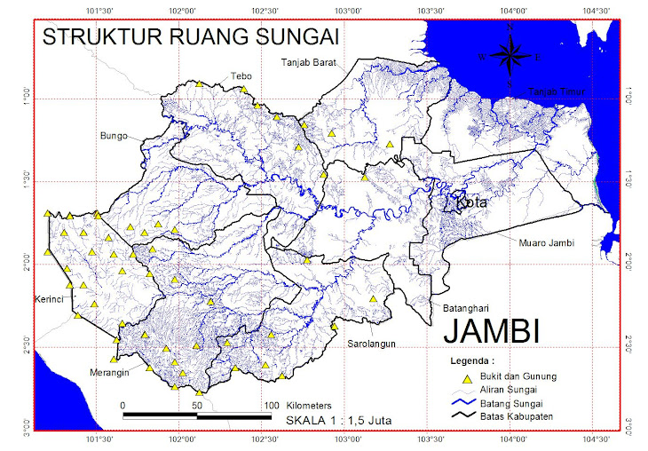
Struktur Sungai

Struktur Sungai

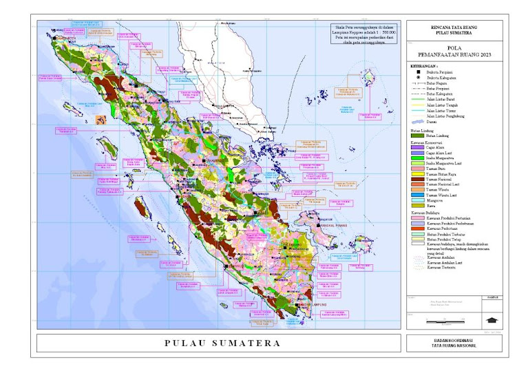
POLA RUANG SUMATERA

POLA RUANG SUMATERA

Kec. Jambi Selatan - Kota Jambi

Kec. Jambi Selatan - Kota Jambi

BERHALE ISLAND

Pulau Berhala
Large selection of World Maps at stepmap.com
StepMap Pulau Berhala


ISI IDRISI TAIGA

ISI IDRISI TAIGA

HOW TO GOIN ON BERHALE ISLAND

Kota Jambi

Desa Batu Kerbau - Kab. Bungo

Desa Batu Kerbau - Kab. Bungo

TERAKHIR DI UPDATE GOOGLE

COMMUNICATE

+62 812731537 01